Weather forecaster Veronica Torres of the Philippine Atmospheric, Geophysical and Astronomical Services Administration (Pagasa) said the storm alert was up over the northern portion of Catanduanes (Pandan, Gigmoto, Bagamanoc, Panganiban, Viga, Caramoran).
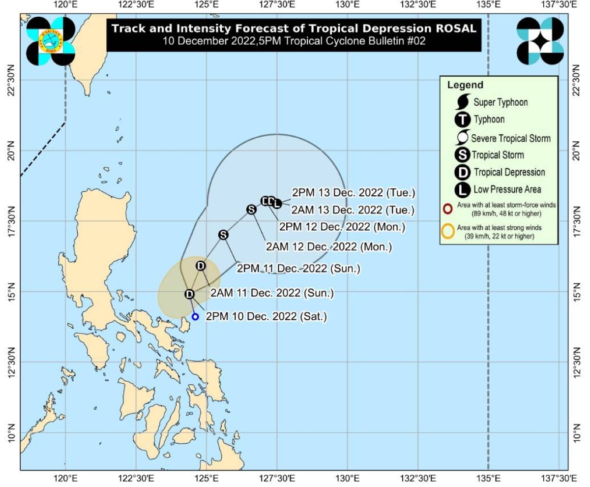
Quoting an advisory issued past 4 p.m. Torres said Rosal was estimated at 295 kilometers east of Infanta, Quezon.
Moving north-northwestward at 15 kilometers per hour (kph), the tropical depression has maximum sustained winds of 45kph near the center and gustiness of up to 55kph, Pagasa said.
At the moment, Rosal is bringing rains with gusty winds over Catanduanes in Bicol Region, she said.
In the next 24 hours, the Pagasa forecaster said the tropical depression may reach tropical storm category as it is forecast to intensify while moving over the Philippine Sea.
“However, due to the interaction with the northeast monsoon (‘amihan’), the tropical cyclone may weaken into tropical depression on Monday and become a remnant low on Tuesday,” she said..
Meanwhile, Pagasa said amihan is affecting Batanes and Babuyan Islands where cloudy skies with light rains may prevail.
It added that Metro Manila, the rest of Cagayan Valley, Aurora, Calabarzon (Cavite, Laguna, Batangas, Rizal and Quezon), Mimaropa (Mindoro, Marinduque, Romblon and Palawan), the rest of Bicol Region and Visayas may likely have cloudy skies with scattered rain showers and thunderstorms due to the trough of Rosal and shear line.
The rest of the country may have partly cloudy to cloudy skies with isolated rain showers or thunderstorms caused by the localized thunderstorms.