
Metro Manila, Philippines— While Super Typhoon Mawar is less likely to make landfall in the country, storm signals may still be raised once it enters the country’s weather monitoring area, the Philippine Atmospheric, Geophysical and Astronomical Services Administration (PAGASA) said Wednesday.
“Sa ating pagtaya po nananatiling mababa ang tsansa, o less likely, na mag-landfall ito sa anumang bahagi ng ating bansa pero patuloy po nating mino-monitor dahil posible rin tayong magtaas ng mga warning signal,” PAGASA weather specialist Ana Clauren-Jorda told CNN Philippines.
[Translation: Based on our projection, it is less likely to make landfall in any part of the country but we are monitoring because we may still raise warning signals.]
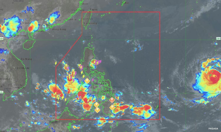
The state weather bureau said Mawar was last located 2,215 kilometers east of Visayas, packing maximum sustained winds of up to 185 kilometers per hour (kph) and gustiness of up to 230 kph.
It is slowly moving northwest and may enter the Philippine Area of Responsibility (PAR) Friday evening or early Saturday morning. Once inside the country’s weather monitoring area, it will be called “Betty,” the agency added.
Jorda also said the weather disturbance will likely maintain its super typhoon category once it enters PAR.
By Friday or Saturday, rains will be experienced in Palawan, Visayas, and Zamboanga as Mawar enhances the southwest monsoon or habagat. It will also bring rains over the western section of the country, she added.
Agencies are already gearing up for the expected entry of Mawar.
Social Welfare Secretary Rex Gatchalian said 690,000 relief goods were already distributed as his department also works on doubling the stockpile of food packs in Ilocos Region and Cagayan Valley, which is currently at 30,000.