
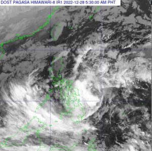
A low pressure area (LPA) located east of Surigao del Sur will bring rain showers over Palawan, Visayas, and four other areas on Wednesday, PAGASA said in its weather forecast.
At 3 a.m., the LPA was estimated to be located at 475 km east of the municipality of Hinatuan.
“‘Yung low pressure area ay medyo malapit na po sa Mindanao. Kasalukuyang nasa dagat pa ito. Bumaba ang tsansa na maging bagyo ito pero hindi natin inaalis ang posibilidad na maging bagyo ito dahil nasa dagat pa ito,” PAGASA weather specialist Aldczar Aurelio said in an interview on GMA Integrated News’ Unang Balita.
(The low pressure area is near Mindanao. Currently it is still at sea. Its chance of becoming a tropical depression is low but we are not ruling out the possibility that it may intensify since it is still at sea.)
Palawan, Visayas, Zamboanga Peninsula, Northern Mindanao, Caraga, and Davao Region will have cloudy skies with scattered rain showers and thunderstorms due to the LPA. Flash floods or landslides may result due to moderate to at times heavy rains.
Cagayan Valley, Cordillera Administrative Region, Aurora, Quezon and Bicol Region meanwhile will have cloudy skies with rains due to the Northeast Monsoon (Amihan) affecting Luzon. Due to moderate to at times heavy rains, flash floods or landslides may occur.
Metro Manila and the rest of Luzon will have partly cloudy to cloudy skies with light rains due to the monsoon.
The rest of Mindanao meanwhile will have partly cloudy to cloudy skies with isolated rain showers or thunderstorms due to localized thunderstorms. During severe thunderstorms, flash floods or landslides may result.
Coastal waters will be moderate to rough in all seaboards in Luzon, Visayas and Mindanao.
Sunrise was at 6:19 a.m. while sunset will be at 5:36 a.m. —KG, GMA Integrated News