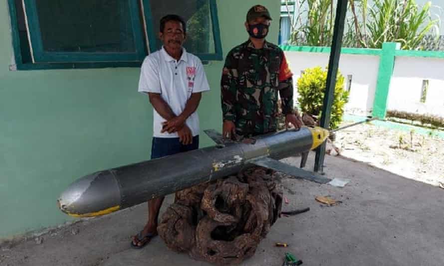
Navy seizes UUV, likely a Chinese Sea Wing, that experts say could be used to plot routes for military subs

An Indonesian fisher has found what experts say is likely to be a Chinese submarine drone in waters on a strategic maritime route from the South China Sea to Australia.
According to Indonesian media the unmanned underwater vehicle (UUV) was found on 20 December near Selayar Island in South Sulawesi. Six days later it was handed to police and then transferred to the Indonesian military.
Military observers have said the drone appears to be a Chinese Sea Wing (or Haiyi) UUV. The underwater glider was developed by the Shenyang institute of automation at the Chinese Academy of Sciences, and is publicly described as collecting data including seawater temperature, salinity, turbidity and oxygen levels. Information on currents and movement direction are transmitted in real time.
The Chinese central government has not commented.
According to the military-focused outlet Naval News, UUV data can be extremely valuable to naval planners, in particular for submarine operations: “The better a navy knows the waters, the better it is able to hide its submarines.”
China has been accused of expansionist activities in the disputed South China Sea and has conducted widespread oceanographic research in regions believed to be militarily significant. In 2019 China conducted ocean surveys to the north of Papua New Guinea, where the US and Australia operate a joint naval base on Manus Island, and in March this year near Christmas Island, an Australian territory north-west of the main continent. Submarines are known to regularly transit in the area, the ABC reported at the time.
An Indonesian security analyst, Muhammad Fauzan, told the ABC the drone was most likely mapping future submarine routes, given it was found far from Chinese waters and in a significant maritime route between China and Australia’s northernmost city of Darwin.
Fauzan said there were significant questions around whether the drone, if a Chinese instrument, was being used for intelligence gathering or illegal surveying.
“It is at least the third time that such a drone, which I and many people including experts believe was a Chinese-made underwater drone, [has been] found in Indonesian territorial waters,” he said.
“But perhaps this latest discovery is a more significant one because first, it is reported that the drone is still active when the fishermen found it. They said that the drone was still moving and the light was still blinking and the forward sensors were still working. And this is the first time we have heard that the military publicly say that they have secured the drone and are conducting a full investigation of the drone which, according to the latest report, is currently being carried out in the second fleet headquarters of the Indonesian navy in Surabaya.”
A different variant of the Sea Wing UUV was discovered by Indonesian fishers in March 2019 in the Riau Islands nearer the South China Sea, and another in January this year in East Java. In December 2016 a Chinese navy ship found and seized a US underwater drone in international waters near its coastline that the US navy was in the process of recovering.
“The Chinese navy ship ASR-510, a Dalang III-class ship, approached within 500 yards of the [US ship] Bowditch, launched a small boat, and seized the UUV,” the Pentagon said in a statement at the time.
The UUV was only returned after the incident escalated.
Non-electric mechanicals and low energy consumption mean the drones can be used for months or even years, according to Chinese state media. A report said UUVs had been tested and used in the East China Sea, South China Sea, Indian Ocean and Pacific Ocean. The Sea Wings had spent more than 6,400 days at sea, observed more than 160,000km and reached depths of 7,076 metres in the Mariana trench.
In February 2020 China’s ministry of natural resources said China had deployed 12 Sea Wing UUVs in the Indian Ocean for scientific research.
