
Typhoon Falcon (international name: Khanun) intensified further on Monday while moving north northwestward over the Philippine Sea. It continues to enhance the Southwest Monsoon (Habagat) which will bring occasional to monsoon rains over the western portion of Luzon in the next three days, PAGASA said in its bulletin.
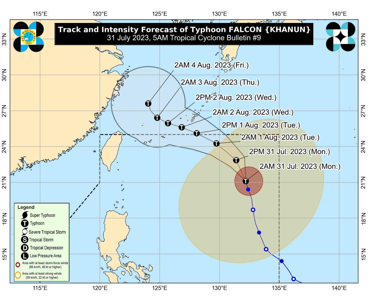
At 4 a.m., the center of Falcon was estimated to be located at 1,070 km east of Extreme Northern Luzon.
Falcon has maximum sustained winds of 150 km/h near the center, gustiness of up to 185 km/h, and central pressure of 950 hPa.
The typhoon is moving north northwestward at 15 km/h.
From its center, strong to typhoon-force winds are extending outwards up to 750 km.
Rainfall, winds
PAGASA said rainfall will generally be higher in elevated or mountainous areas.
“Under these conditions, flooding and rain-induced landslides are expected especially in areas that are highly or very highly susceptible to these hazard as identified in hazard maps and in localities that experienced considerable amounts of rainfall for the past several days,” it added.
PAGASA said storm signals are unlikely to be raised based on the current forecast scenario.
Gusty conditions however will be experienced over the following areas, especially in coastal and upland/mountainous areas exposed to winds:
- Monday: Zambales, Bataan, Cavite, Lubang Island, Kalayaan Islands, Cuyo Islands, Romblon, the northwestern portion of Antique, Camarines Sur, and Albay;
- Tuesday: Batanes, Babuyan Islands, Abra, Benguet, Zambales, Bataan, the central and southern portions of Aurora, Pampanga, Bulacan, Metro Manila, and most of Ilocos Region, Calabarzon, Mimaropa, Bicol Region, and Western Visayas; and
- Wednesday: Batanes, Babuyan Islands, Ilocos Region, Abra, Benguet, Aurora, Zambales, Bataan, Bulacan, Pampanga, Metro Manila, Calabarzon, MIMAROPA, Bicol Region, the western portion of Northern Samar, and most of Western Visayas.
Coastal waters
PAGASA has lifted the gale warning which was in effect the past few days.
Coastal waters however will be moderate to rough in the next 24 hours over the coastal waters along the northern, western, and southern seaboards of Luzon due to the Southwest Monsoon enhanced by Falcon.
“Mariners of small seacrafts are advised to take precautionary measures when venturing over these waters. If inexperienced or operating ill-equipped vessels, avoid navigating in these conditions,” PAGASA said.
Track, intensity outlook
Falcon is expected to slightly accelerate on Monday then turn west northwestward on Tuesday while starting to decelerate.
The typhoon is forecast to exit the Philippine Area of Responsibility (PAR) between Tuesday morning and afternoon.
Falcon will then turn west northwestward and pass close over Okinawa Islands in Japan between Tuesday evening and Wednesday morning while decelerating.
The typhoon is expected to continue intensifying in the next one to two days and may reach peak intensity on Tuesday or Wednesday.
PAGASA advised the public and disaster risk reduction and management offices concerned to take all necessary measures to protect life and property.
The next weather bulletin will be issued at 11 a.m. by PAGASA.
Classes
Classes for Monday have been canceled in some areas due to the lingering effects of Typhoon Egay and the effects of Falcon. —KG, GMA Integrated News