
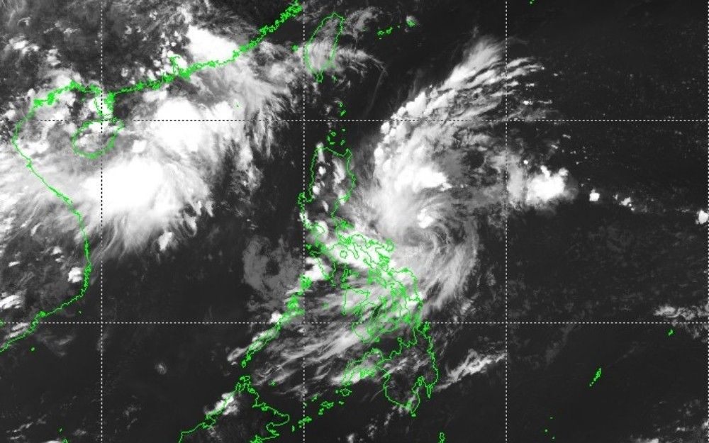
Tropical cyclone Luis as seen in a satellite image rendering as of 2:40 p.m, Aug. 2, 2026. PAGASA
Signal No. 1 up over parts of Bicol, Quezon as TD Luis intensifies
MANILA – The Philippine Atmospheric, Geophysical and Astronomical Services Administration (PAGASA) on Sunday raised Tropical Cyclone Wind Signal (TCWS) No. 1 over parts of Bicol and Quezon as Tropical Depression Luis moved northwestward over the Philippine Sea east of Quezon province.
Under Signal No. 1 are the Polillo Islands, Camarines Norte, Catanduanes, and the northern portion of Camarines Sur, including the municipalities of Caramoan, Presentacion, Garchitorena, Lagonoy, Tinambac, Siruma, Goa, San Jose, Tigaon, and Calabanga.
PAGASA said winds of 39 to 61 kilometers per hour are expected over these areas, posing minimal to minor threats to life and property. The weather bureau said raising TCWS No. 2 remains possible should the tropical cyclone continue to intensify.
As of 10 a.m., Luis was located about 400 kilometers east of Infanta, Quezon. It was packing maximum sustained winds of 55 kilometers per hour near the center and gusts of up to 70 kph while moving northwestward at 15 kph. Its strong winds extend up to 150 kilometers from the center.
PAGASA said Luis is expected to continue moving northwest over the next 24 hours before turning east-northeast for the remainder of the forecast period. Based on the latest track, the cyclone is expected to remain over the Philippine Sea.
However, the weather bureau warned that any westward shift could bring the storm close to or over Northern or Central Luzon. It added that adjustments to the forecast track remain possible as the system develops.
Luis is forecast to strengthen into a tropical storm within the next 24 hours while over the waters east of Central Luzon. It is expected to remain at tropical storm intensity only briefly before weakening as it moves east-northeast.
By Wednesday, Aug. 5, the cyclone may weaken into a remnant low before being absorbed by the circulation of Typhoon Dolphin, PAGASA said.
The southwest monsoon, or habagat, enhanced by the outer circulation of Luis, is also expected to bring strong to gale-force winds over several areas outside the tropical cyclone wind signal.
On Sunday, these conditions may affect Marinduque, the southern portions of Occidental Mindoro and Oriental Mindoro, Romblon, mainland Masbate, Caluya Islands, Siquijor, Southern Leyte, Camiguin, and Dinagat Islands.
From Monday to Tuesday, strong to gale-force winds may prevail over most of Luzon and the Visayas, as well as Lanao del Norte, Misamis Occidental, Camiguin, Surigao del Norte, Dinagat Islands, Davao Occidental, and Davao Oriental.
PAGASA also issued a separate rainfall advisory, warning that Tropical Depression Luis and the southwest monsoon may bring moderate to heavy rains over parts of Luzon and the Visayas. The agency urged the public and local disaster officials to continue monitoring weather updates and take necessary precautions against flooding, landslides, and other weather-related hazards.