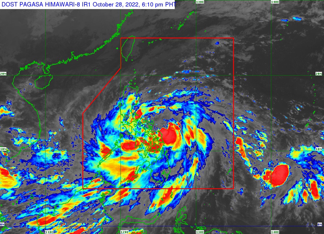
 MANILA, Philippines — Tropical Storm Paeng (international name: Nalgae) slightly intensified as it continues to move west-northwestward and has prompted state meteorologists to raise Tropical Cyclone Wind Signal (TCWS) Number 2 in several parts of Luzon and the Visayas, including Metro Manila.
The Philippine Atmospheric, Geophysical and Astronomical Services Administration (Pagasa), in its 5:00 p.m. update, reported that Paeng’s new forecast track slightly dipped south, which means it may now hit the Bicol region and Quezon province.
Pagasa added that Paeng was last spotted some 180 kilometers east of Catarman, Northern Samar, packing maximum sustained winds of 85 kilometers per hour (kph) near the center and gustiness of up to 105 kph.
It is forecast to cross Camarines Sur at around 2:00 a.m. Saturday.
Pagasa expects Paeng to be over the West Philippine Sea by Sunday afternoon. It would recurve towards the extreme Northern Luzon area.
Tropical Cyclone Wind Signal No. 2 is up over the following areas / provinces:
Luzon:
-
- Metro Manila
- Catanduanes
- Albay
- Sorsogon
- Masbate including Ticao Island and Burias Islands
- Camarines Sur
- Camarines Norte
- Marinduque
- northern and central portions of Oriental Mindoro (Puerto Galera, San Teodoro, Baco, City of Calapan, Naujan, Victoria, Pola, Socorro, Pinamalayan, Gloria, Bansud, Bongabong, Roxas)
- Romblon
- Quezon including Pollilo Islands
- Laguna
- Batangas
- Cavite
- Rizal
- the southern portion of Aurora (San Luis, Baler, Dingalan)
- southeastern portion of Nueva Ecija (Gabaldon, General Tinio, City of Gapan, Cabiao, San Isidro)
- Bulacan
- eastern portion of Pampanga (Candaba, San Luis, San Simon, Apalit)
- Visayas:
- Northern Samar
- Eastern Samar
- Samar
Biliran - northern portion of Leyte (San Isidro, Calubian, Tabango, Leyte, Capoocan, Carigara, Barugo, San Miguel, Babatngon, Tacloban City, Alangalang, Santa Fe, Palo, Tanauan, Dagami, Pastrana, Jaro, Kananga, Villaba, Tunga, Tabontabon, Tolosa)
Tropical Cyclone Wind Signal No. 1 is up over the following areas / provinces:
- Luzon:
- Nueva Vizcaya
- Quirino
- central and southern portions of Isabela (San Agustin, Jones, City of Santiago, Cordon, Echague, Dinapigue, San Mariano, San Guillermo, Angadanan, City of Cauayan, Benito Soliven, Ramon, San Isidro, Alicia, San Mateo, Cabatuan, Luna, Reina Mercedes, Naguilian, Palanan, Aurora, Burgos, San Manuel, Gamu, Ilagan City, Divilacan, Roxas, Quirino, Mallig)
- Ifugao
- Benguet
- Mountain Province
- southern portion of Ilocos Sur (Sugpon, Cervantes, Alilem, Suyo, Tagudin, Santa Cruz, Sigay, Quirino, Gregorio del Pilar, Salcedo, Santa Lucia)
- La Union
- Pangasinan
- Bataan
- Tarlac
- Zambales
- the rest of Aurora
- the rest of Pampanga
- the rest of Nueva Ecija
- Occidental Mindoro including Lubang Islands
- the rest of Oriental Mindoro
- ]Calamian Islands
- Cuyo Islands
- Visayas:
- Southern Leyte
- Cebu including Bantayan and Camotes Islands
- Bohol
- Negros Occidental
- Negros Oriental
- Guimaras
- Aklan
- Antique
- Capiz
- Iloilo
- Siquijor
- the rest of Leyte
- Mindanao:
- Dinagat Islands
- Surigao del Norte including Siargao and Bucas Grande Islands
- northern portion of Surigao del Sur (Carrascal, Cantilan, Madrid, Carmen, Lanuza, Cortes, City of Tandag, Bayabas, Cagwait, San Miguel, Tago, Marihatag)
- Agusan del Norte
- northeastern portion of Agusan del Sur (Sibagat)
- Camiguin,
- eastern portion of Misamis Oriental (Gingoog City, Magsaysay, Medina, Talisayan, Balingoan, Kinoguitan)
